22 May 2026 · 3 min read
The Lava That Left a Reef of Columns: Tasmania's Tasman Peninsula Dolerite
How Jurassic flood basalt in Tasmania cooled into the towering dolerite columns of the Tasman Peninsula—and what that tells us about the moment Gondwana began to crack apart.
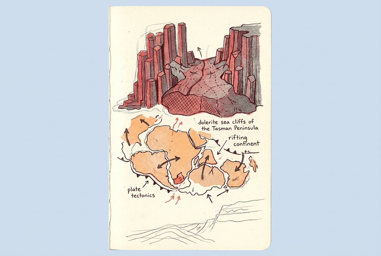
On Tasmania's Tasman Peninsula, the sea cliffs rise in perfect vertical columns, stacked like organ pipes against the Southern Ocean. The columns are dolerite—a rock that formed when molten magma cooled slowly deep underground, then was exposed by the slow work of waves and weather.
The cliffs at Cape Raoul and Cape Pillar stand roughly 300 metres tall. Their hexagonal columns are not an accident of erosion. They are a record of how magma cools.
The Cooling That Made the Columns
About 180 million years ago, during the Jurassic period, a massive flood-basalt event tore across what is now Tasmania. This was not a single volcano but a vast province of fissure eruptions, part of the same thermal upheaval that would eventually break Gondwana apart. Magma surged through cracks in the crust and spread in horizontal sheets called sills, each hundreds of metres thick.
As each sill cooled, it contracted. The contraction created tensile stress, and the stress organised itself into a regular pattern: hexagonal fractures that ran vertically through the cooling rock. This is the same process that forms mud cracks in a dry lake bed, scaled up by orders of magnitude. The result is columnar jointing—the geometric columns that now form the sea cliffs of the Tasman Peninsula.
The columns are not all identical. Where cooling was slower, near the centre of the sill, the columns are wider—some more than two metres across. Near the margins, where heat bled away faster, the columns are narrower and more irregular. The entire sill, called the Tasmanian Dolerite, covers roughly 70 percent of the island's surface, making it one of the most extensive exposures of its kind on Earth.
The rock records the exact moment a continent began to die and an ocean began to be born.
The Rift That Opened an Ocean
The dolerite sills of Tasmania are not an isolated curiosity. They are a scar from the breakup of Gondwana. When the supercontinent began to rift in the Jurassic, the crust thinned and stretched. Hot mantle rock rose into the thinning crust and melted. The melt—basaltic magma—flooded the landscape, intruding into existing sedimentary rocks.
The same magmatic event that fed Tasmania's dolerite sills also fed the Ferrar Large Igneous Province in Antarctica and the Karoo-Ferrar province in southern Africa. These are not separate events. They are the same event, now scattered across three continents by 180 million years of plate motion.
The rifting did not succeed immediately. The magma stalled, cooled, and hardened. It took another 80 million years for the final separation to occur, when the Tasman Sea opened between Australia and Zealandia. But the dolerite sills mark the first deep crack in Gondwana's armour.
The Erosion That Revealed the Architecture
The dolerite columns now exposed on the Tasman Peninsula were never meant to see the sky. They formed kilometres underground, within the crust. What we see today is the result of 180 million years of uplift and erosion, stripping away the softer sedimentary rocks that once covered the sill.
The columns at Cape Raoul and Cape Pillar are among the most dramatic examples. The sea has undercut the cliffs, leaving towering pillars that stand isolated from the main cliff face. The Totem Pole, a slender spire of dolerite rising 65 metres from the sea, is a single column isolated by wave action on both sides. It will eventually fall, as all columns do, and the cliff will retreat.
Further north, at the Tessellated Pavement near Eaglehawk Neck, the same dolerite has been eroded along its joints to create a flat surface that looks like a tiled floor. The tide fills the joints with water, revealing the perfect geometry of the original cooling fractures.
The Time That Remains
The Tasmanian Dolerite is a quiet monument to deep time. The columns formed in a period of geological unrest that lasted perhaps a few million years—a blink in Earth's history. They have been exposed by erosion over tens of millions of years more. And they will eventually be ground down to sand.
But for now, they stand at the edge of the continent, recording the moment a supercontinent began to tear apart. The same magma that built the columns also split the land, opened oceans, and set Australia adrift. The columns are the fossil of that rupture, frozen in stone.
More like this
- The 110-Million-Year-Old River That Runs Backwards UndergroundWestern Australia's 110-million-year-old dune system has been slowly dissolving into a labyrinth of caves where an ancient river still flows, carrying the taste of a Cretaceous desert.
- The 5,000-Year-Old Volcanoes That Still Smoke in the SouthIn Victoria's Newer Volcanics Province, 400 volcanic vents erupted as recently as 5,000 years ago—the youngest volcanic field in mainland Australia, where craters still hold blue lakes and scoria cone
- The 1.75-Billion-Year-Old Reef That Outranks the BarrierA 1.75-billion-year-old microbial reef in the Kimberley is the largest biological structure ever built by a single species, preserving a world without predators.