10 May 2026 · 3 min read
The Drowned River: The Murray Canyon of the Continental Shelf
Beneath the Southern Ocean off South Australia, the Murray River's ancient channel continues across the seafloor as a 150-kilometre submarine canyon, carved when the shelf was dry land.
The Murray River does not end at the sea. It continues, hidden, for another 150 kilometres across the floor of the Southern Ocean—a drowned valley carved when the continental shelf stood exposed as dry land. The Murray Canyon is a river system that outlived its own continent.
A Valley Beneath the Waves
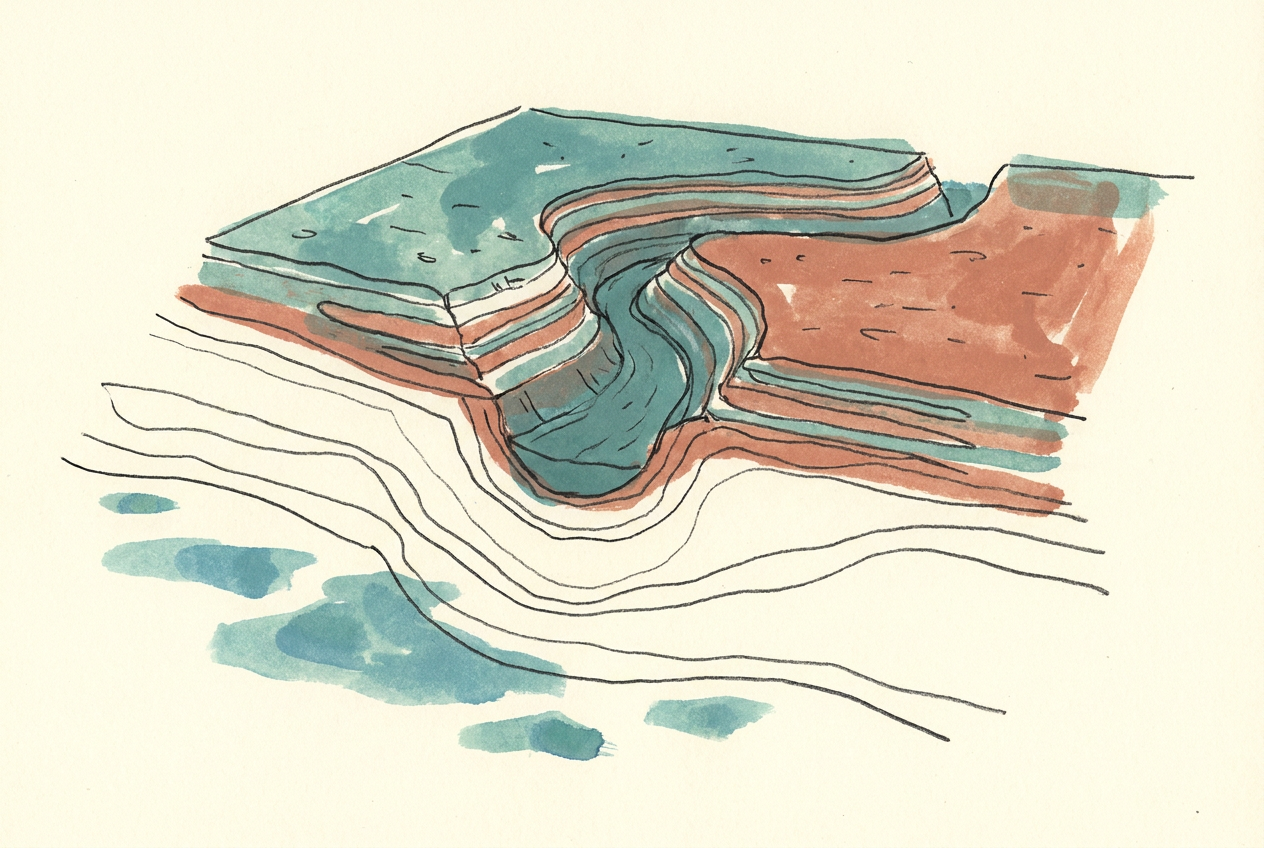
The Murray Canyon begins where the modern river mouth meets the sea near Goolwa, South Australia. From there, the ancient channel cuts across the Lacepede Shelf, descending the continental slope into the abyssal plain of the Southern Ocean. The canyon's walls rise 400 metres above its floor. Its tributaries—the Bonney Canyon, the Sprigg Canyon, the Du Couedic Canyon—branch like the fingers of a buried tree.
These are not features carved by submarine currents alone. They are the preserved traces of the Murray River as it existed during the Pleistocene, when sea levels dropped by 120 metres during glacial maxima. The river simply kept flowing, cutting deeper into what was then coastal plain. When the ice melted and the sea rose again, the valley was flooded and preserved.
The Shelf That Was Land
For most of the past two million years, the Lacepede Shelf was dry ground. The coastline sat near the present-day shelf edge, 80 to 100 kilometres south of where it sits now. Kangaroo Island was a hill on a grassy plain. The Coorong lagoon did not exist—its basin was a river valley.
The Murray Canyon records this lost geography. Its shape is dendritic, branching like a terrestrial river system because that is exactly what it was. Seismic surveys show meander loops, cut-off channels, and terraces that match the patterns of subaerial erosion. The canyon is a fossil of a coastline that has since drowned.
The shelf edge was once a shoreline. The abyss was once a horizon.
Sediment and Memory
The canyon funnels sediment from the Murray-Darling Basin into the deep ocean. Each glacial cycle delivered pulses of sand, silt, and clay that built submarine fans on the abyssal plain. These deposits preserve a record of Australian climate stretching back hundreds of thousands of years—pollen grains, charcoal from ancient fires, the shells of foraminifera that track ocean temperatures.
Core samples from the fan show alternating layers: coarse sediment from glacial periods when the river ran fast and the shelf was exposed; fine muds from interglacials when the sea rose and the river slowed. The canyon is a sediment archive, written in grain size and organic debris.
The Slow Flood
The drowning of the Murray Canyon was not a single event but a series of floods. Each time the ice sheets retreated, the sea rose slowly—centimetres per decade. The river mouth migrated northward, retreating up its own valley. The last major transgression, beginning about 18,000 years ago, raised sea levels from 120 metres below present to near-modern levels by 6,000 years ago.
The canyon did not fill with sediment. The rising sea drowned it faster than the river could infill the channel. So the valley remained, a negative imprint of the landscape that was, now flooded and dark, invisible from the surface but perfectly preserved in bathymetric maps.
Today, the Murray Canyon is a feature few Australians know exists. It lies beneath shipping lanes and fishing grounds, unnoticed. But it is there—a river that remembers when the continent was larger, when the coast was further south, when the sea was lower. A drowned river, still tracing the path it carved when the world was colder and the land was wider.
More like this
- The 110-Million-Year-Old River That Runs Backwards UndergroundWestern Australia's 110-million-year-old dune system has been slowly dissolving into a labyrinth of caves where an ancient river still flows, carrying the taste of a Cretaceous desert.
- The 5,000-Year-Old Volcanoes That Still Smoke in the SouthIn Victoria's Newer Volcanics Province, 400 volcanic vents erupted as recently as 5,000 years ago—the youngest volcanic field in mainland Australia, where craters still hold blue lakes and scoria cone
- The 560-Million-Year-Old Garden That Never Saw a PredatorIn South Australia's Flinders Ranges, 560-million-year-old Ediacara surfaces preserve entire seafloor communities of fronds, discs, and quilts — a garden of soft-bodied life that flourished before pre