7 July 2026 · 3 min read
The 300-Million-Year-Old Teeth That Still Mark the Hills
How a 300-million-year-old glacial pavement in the Sydney Basin records the Permian ice age when Australia sat at the South Pole—and the striations carved by ancient ice still visible today.
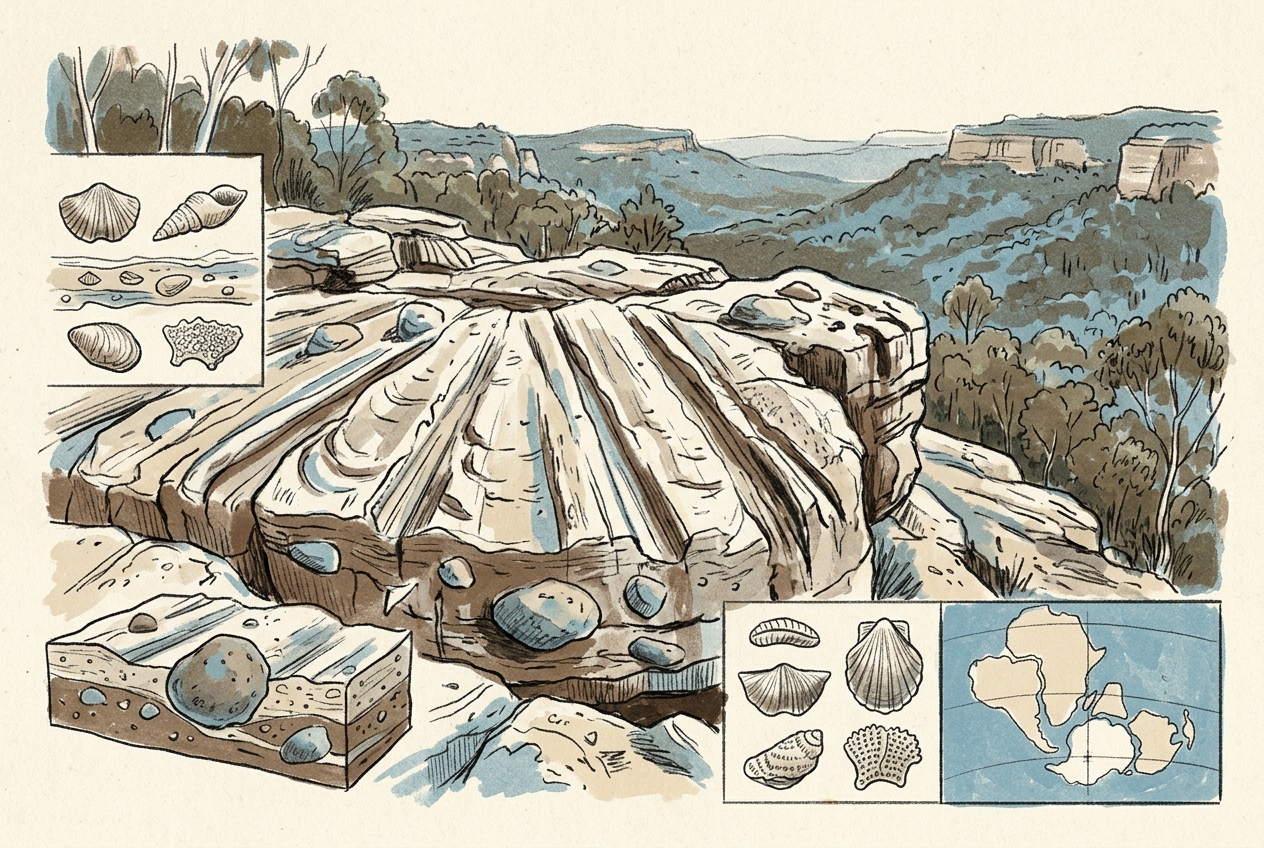
One hundred kilometres north of Sydney, the Hawkesbury Sandstone lifts into a long, low ridge called the Watagan Mountains. On its western flank, near the township of Wollombi, the bare rock carries a set of parallel grooves that look as if a giant comb was dragged across the stone. These are not the work of machinery or weather. They are the tooth marks of a 300-million-year-old ice sheet.
The Ice That Covered a Continent
In the late Carboniferous and early Permian, between about 320 and 280 million years ago, Australia sat at the South Pole. It was the eastern edge of Gondwana, and a continental ice sheet two to three kilometres thick pressed down on what is now New South Wales.
The ice moved northward across the landscape, grinding bedrock with debris frozen into its base. Sand grains and pebbles embedded in the basal ice acted like abrasive grit on a sanding block. Where the ice dragged harder rock—quartzite or volcanic boulders—over softer sandstone, it cut straight, parallel scratches called striations.
These striations survive today on dozens of exposed rock surfaces across the Sydney Basin. The best examples occur at Piles Creek, near Wollombi, and along the escarpment of the Watagan Mountains. They are the oldest direct evidence of continental glaciation on Australia's east coast.
A single striation, a few millimetres deep, can tell you the direction the ice was moving, the pressure it exerted, and the hardness of the rock it carried.
A Landscape Frozen in Motion
The glacial pavement at Piles Creek is a slab of Permian sandstone tilted gently westward. The striations run roughly north-south, confirming that the ice sheet flowed from the polar highlands of the Lachlan Fold Belt toward the lowland Sydney Basin.
What makes these marks remarkable is not their age alone. It is the precision with which they record a vanished world. The grooves are not random; they follow the regional palaeoflow pattern mapped across hundreds of kilometres. In places, the striations cross each other at shallow angles, recording shifts in ice direction as the sheet waxed and waned over hundreds of thousands of years.
Beneath the striated surface lies the Permian glacial sequence itself—tillites, dropstones, and varved shales deposited when the ice retreated and lakes formed in its wake. The scratches on the pavement are the top of that story, the moment the ice was still moving.
The Rock That Held the Record
The sandstone that preserves these marks is the basal unit of the Permian sequence, laid down as sand dunes and river channels before the ice arrived. It was already lithified when the glacier overrode it. Had the sandstone been loose sand, the ice would have simply bulldozed it away.
Instead, the ice sheet polished the rock to a smooth surface and then scratched it. The polish, called glacial slickenside, is still visible on some surfaces as a waxy sheen. After the ice melted, the pavement was buried by younger sediments and only re-exposed by recent erosion. That burial protected the striations from chemical weathering and biological growth for nearly 300 million years.
What the Scratches Tell Us Now
The glacial pavements of the Watagan Mountains are not a tourist attraction. They sit on public land but receive few visitors. Geologists have studied them since the 1880s, using the striations to reconstruct the Permian ice sheet's thickness, extent, and flow dynamics.
The data shows that the ice sheet was not a single dome but a complex of coalescing ice streams, much like West Antarctica today. Flow directions changed as the ice thinned and the underlying topography influenced movement. The striations record these shifts in fine detail.
They also confirm that the Sydney Basin was a glacial trough, similar to the fjords of Norway or the Great Lakes of North America, but filled with sediment rather than water. The same ice that scratched the pavement also carved the basin's underlying shape.
The Permian ice age ended when Gondwana drifted northward and carbon dioxide levels rose. The ice melted, the sea returned, and the coal swamps that would later power Sydney's industry grew over the glacial debris. But the scratches remained, hidden beneath the earth, waiting for the moment when erosion would pull back the cover and show us what the ice had written.
More like this
- The 110-Million-Year-Old River That Runs Backwards UndergroundWestern Australia's 110-million-year-old dune system has been slowly dissolving into a labyrinth of caves where an ancient river still flows, carrying the taste of a Cretaceous desert.
- The 5,000-Year-Old Volcanoes That Still Smoke in the SouthIn Victoria's Newer Volcanics Province, 400 volcanic vents erupted as recently as 5,000 years ago—the youngest volcanic field in mainland Australia, where craters still hold blue lakes and scoria cone
- The 560-Million-Year-Old Garden That Never Saw a PredatorIn South Australia's Flinders Ranges, 560-million-year-old Ediacara surfaces preserve entire seafloor communities of fronds, discs, and quilts — a garden of soft-bodied life that flourished before pre