26 June 2026 · 3 min read
The 23-Million-Year-Old Volcano That Left a Ring of Mountains
How the Tweed Volcano, one of the largest shield volcanoes in the Southern Hemisphere, was eroded into the mountain ranges that now define the Queensland-NSW border.
Twenty-three million years ago, a shield volcano the size of a small country rose above the border where Queensland meets New South Wales. Today, almost nothing remains of it—except the mountains that were once its edges.
The Shield That Vanished
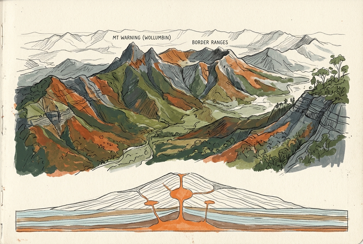
The Tweed Volcano was not a steep cone. It was a shield volcano, broad and gentle-sloped, built by countless flows of fluid basalt. At its peak, it may have stood three kilometres above the surrounding plain and spanned more than 100 kilometres across—one of the largest shield volcanoes ever to erupt in the Southern Hemisphere.
The volcano sat above a hot spot, a plume of mantle magma that punched through the eastern edge of the Australian continent as it drifted north. For three million years, from 23 to 20 million years ago, lava poured across the landscape. It buried ancient river valleys and forests under layers of basalt up to a kilometre thick in places.
Then the eruptions stopped. The hot spot moved south as the plate continued its slow drift, and the volcano went cold.
The Slow Unmaking
What followed was not a violent collapse but a long, patient erasure. Rain, wind, and the slow work of rivers attacked the volcano's soft basalt flanks. Over millions of years, they stripped away the mountain, carrying its remains to the sea.
But not everything eroded evenly. The volcano's plumbing—the dykes, sills, and the central plug of tougher rock that had once fed the eruptions—resisted erosion better than the surrounding basalt. As the shield was worn down, these harder remnants emerged from the retreating landscape.
The most prominent of them is Wollumbin, known today as Mount Warning. This 700-metre peak is the exposed throat of the ancient volcano, a plug of trachyte that cooled deep inside the vent. It now stands far below the original summit, a stump of what was once the volcano's core. Captain James Cook named it Mount Warning in 1770 because its position allowed the first sighting of the sunrise on the Australian coast, but the mountain had already been a beacon for Aboriginal people for tens of thousands of years.
The Ring That Remains
The most striking remnant is not the central plug but the ring of mountains that encircles it. The Border Ranges, the McPherson Range, and the Tweed Range form a great arc, tracing the outer edge of the original volcano. These ranges are made of erosion-resistant volcanic rocks that once lined the shield's flanks—lava flows and volcaniclastics that hardened into something tougher than the rock around them.
What was once the edge of a mountain is now the crest of a range. The volcano has turned inside out.
This process, called inverted relief, has created a landscape that seems backward. The highest points today—Mount Lindesay, Mount Barney, the peaks of Lamington National Park—were not the volcano's summit but its periphery. The centre is gone, hollowed out into the broad, fertile valley of the Tweed River. The ancient shield volcano has become a ring of mountains surrounding a basin where its heart once stood.
A Landscape in Transit
The Tweed Volcano's remains extend far beyond the visible mountains. The basalt flows that once covered the landscape now form the rich red soils of the region's dairy farms and banana plantations. The same lava that buried ancient forests now nourishes new ones in the subtropical rainforests of the Border Ranges, some of the most biodiverse in Australia.
And the hot spot that built the volcano is still active. It now sits beneath the Tasman Sea, building new mountains on the seafloor at the Tasmantid Seamount Chain. The Australian plate continues to drift north at about six centimetres per year, carrying the volcano's scattered bones across the landscape.
The Tweed Volcano is gone. But its absence has become a mountain range, and the ring of peaks that once marked its outer edge now defines one of the most dramatic landscapes on the eastern Australian coast.
More like this
- The 110-Million-Year-Old River That Runs Backwards UndergroundWestern Australia's 110-million-year-old dune system has been slowly dissolving into a labyrinth of caves where an ancient river still flows, carrying the taste of a Cretaceous desert.
- The 5,000-Year-Old Volcanoes That Still Smoke in the SouthIn Victoria's Newer Volcanics Province, 400 volcanic vents erupted as recently as 5,000 years ago—the youngest volcanic field in mainland Australia, where craters still hold blue lakes and scoria cone
- The 300-Million-Year-Old Forest That Died Standing UpIn New South Wales, a 300-million-year-old fossil forest preserves dozens of trees buried upright by a Permian volcanic eruption—an entire ecosystem frozen in ash.