13 May 2026 · 4 min read
The Lava That Became a Shield: The Great Western Volcanic Province
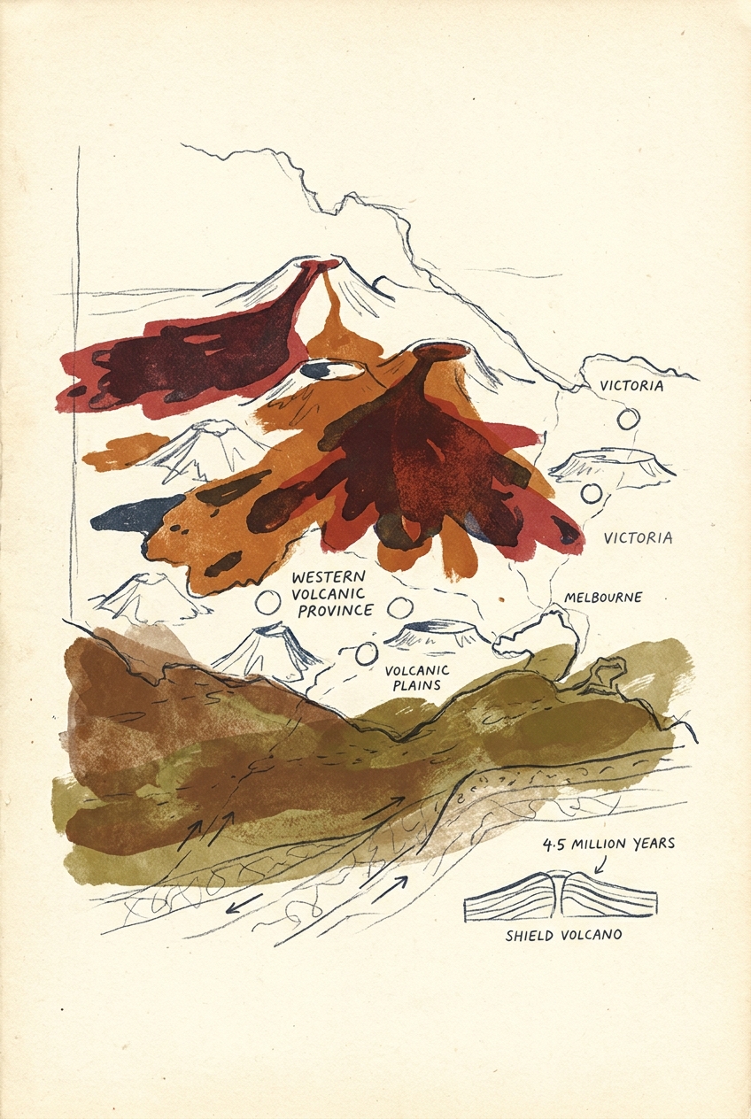
Victoria's 4.5-million-year-old Western Volcanic Province contains over 400 eruption points that shaped the state's richest soils, creating the volcanic plains that underlie Melbourne's western suburb
In western Victoria, the ground beneath your feet was once on fire. Over the past 4.5 million years, more than 400 volcanic vents erupted across the Western Volcanic Province, flooding the landscape with basalt until the lava covered 15,000 square kilometres—an area larger than greater London. The result is the youngest volcanic field in Australia, and one of the most densely cratered landscapes on Earth.
The Newer Volcanics Province
Geologists call it the Newer Volcanics Province, a name that undersells its scale. It stretches from Melbourne's western suburbs all the way to the South Australian border, a flat plain of dark basalt that seems unremarkable until you notice the cones.
More than 400 eruption points dot this plain. Some are scoria cones—steep, reddish hills like Mount Elephant near Derrinallum, which rises 240 metres above the plains. Others are maar craters, formed when rising magma hit groundwater and exploded, leaving shallow lakes ringed by low tuff rims. Tower Hill, near Warrnambool, is a textbook maar: a 3-kilometre-wide crater now filled with wetlands, surrounded by nested scoria cones that erupted through the crater floor after the main explosion ceased.
The province is still active by geological standards. The most recent eruption, at Mount Gambier across the border in South Australia, occurred only 4,300 years ago—yesterday in deep time. The Blue Lake there fills one of those explosion craters.
How the Plains Were Flooded
Unlike the explosive stratovolcanoes of the Pacific Ring of Fire, the Newer Volcanics Province produced mostly fluid basalt lava that flowed like treacle. These are called Hawaiian-style eruptions: lava fountains, not ash clouds.
The source lies in a mantle hotspot or, more likely, a zone of extension where the Australian continent is slowly stretching as it drifts north. As the crust thins, pressure drops, and the mantle begins to melt. The magma rises along fractures, emerging as sheet flows that spread across the existing landscape.
At Mount Rouse, near Penshurst, a single eruption around 20,000 years ago produced lava flows that travelled 50 kilometres down ancient river valleys, damming them and creating new drainage patterns. The flows buried pre-existing soils, preserving pollen and bones beneath the basalt. Those buried surfaces contain records of the climate and vegetation that existed before the lava arrived.
One flow near Port Fairy contains tree moulds—hollows where trunks stood as lava engulfed them, the wood burning away but the shape preserved in stone.
The lava preserved what it destroyed. Beneath the basalt lie fossil soils, pollen grains, and the bones of megafauna that grazed on these plains before the eruptions began.
The Bones Beneath the Basalt
The Western Volcanic Province is not just a volcanic story; it is a palaeontological one. At sites like Spring Creek and Mount Widderin, excavations beneath lava flows have uncovered the remains of Diprotodon, the giant wombat relative that weighed over two tonnes, and Procoptodon, a short-faced kangaroo that stood three metres tall.
These animals lived on the volcanic plains during the Pleistocene. When eruptions occurred, lava sometimes covered their carcasses, sealing them in a tomb of basalt. In other cases, animals fell into lava tubes—collapsed tunnels that once carried molten rock—and were preserved in the cave sediments that later accumulated.
The lava tubes themselves are remarkable. At Byaduk Caves, near Hamilton, a system of collapsed tubes extends for hundreds of metres, with skylights where the roof fell in. Walking through them, you can see the flow structures on the walls: ropey pahoehoe textures, dripstone from when the roof was molten, and the high-level marks where the lava surface stood.
The Living Landscape
The volcanic plains are still changing. Weathering of basalt produces some of Australia's richest soils—red-brown loams that support Victoria's dairy industry and the volcanic slopes that grow the region's famous Pinot Noir.
But the soils are shallow in places, and the underlying basalt creates a distinctive hydrology. Rainwater percolates through cracks in the lava, emerging as springs at the base of flows. These springs sustain wetlands and creeks that would otherwise dry out in summer.
The cones themselves host remnant vegetation. Many are too steep to plough, so they retain patches of native grassland and woodland that have vanished from the surrounding plains. Mount Elephant, now a nature reserve, supports populations of the endangered golden sun moth and the striped legless lizard.
Erosion is slowly softening the landscape. The youngest cones, like Mount Gambier, still have sharp, fresh craters. Older ones, like Mount Noorat, are more subdued, their rims weathered down by 40,000 years of rain and frost. In another million years, the cones will be gone entirely, and only the flat basalt plain will remain—a buried record of the fire that once spread across Victoria.
More like this
- The 110-Million-Year-Old River That Runs Backwards UndergroundWestern Australia's 110-million-year-old dune system has been slowly dissolving into a labyrinth of caves where an ancient river still flows, carrying the taste of a Cretaceous desert.
- The 5,000-Year-Old Volcanoes That Still Smoke in the SouthIn Victoria's Newer Volcanics Province, 400 volcanic vents erupted as recently as 5,000 years ago—the youngest volcanic field in mainland Australia, where craters still hold blue lakes and scoria cone
- The 300-Million-Year-Old Forest That Died Standing UpIn New South Wales, a 300-million-year-old fossil forest preserves dozens of trees buried upright by a Permian volcanic eruption—an entire ecosystem frozen in ash.