16 May 2026 · 3 min read
The Ice That Dug a Gulf: Spencer Gulf's Glacial Origins
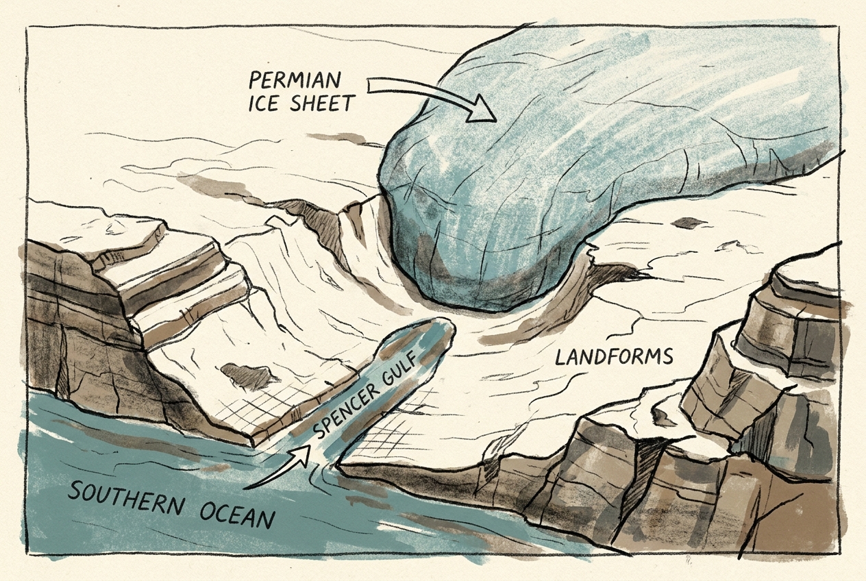
Spencer Gulf in South Australia was carved 280 million years ago by Permian ice sheets that left a deep fjord-like valley later flooded by rising seas.
The water in Spencer Gulf is shallow — rarely deeper than 20 metres — but the valley it fills was once cut a kilometre deep. The ice that carved it is long gone, but the scar remains, flooded by the sea and now ringed by the arid plains of South Australia.
The Permian Ice Sheet
Two hundred and eighty million years ago, during the Permian period, Australia sat near the South Pole. A massive ice sheet, comparable to modern Antarctica's, covered much of the continent. As it moved north across what is now South Australia, the ice followed the path of least resistance: a belt of weak sedimentary rocks sandwiched between harder basement ridges.
The ice sheet was hundreds of metres thick. It scoured the landscape with debris frozen into its base — boulders, sand, and pulverised rock — gouging a deep, linear trough. When the ice finally melted as the Permian climate warmed, it left behind a valley 400 kilometres long and up to 80 kilometres wide, flanked by steep walls of ancient rock.
The valley floor was littered with glacial till: unsorted clay, sand, and boulders dumped directly by retreating ice. Some of these boulders, called erratics, had been carried hundreds of kilometres from source rocks in the Gawler Craton.
The Flooded Valley
For millions of years after the ice retreated, the valley sat as a dry gash across the landscape, slowly filling with sediment. Then, during the interglacial periods of the Pleistocene — starting about 2 million years ago — sea levels rose and fell repeatedly.
Each time the sea rose, it pushed up Spencer Gulf, flooding the old glacial trough. The water reached only as far as the ancient valley walls. Where the ice had cut deep, the sea followed. Where the valley narrowed between resistant ridges, the gulf pinched into the tight channels visible today between the Eyre and Yorke Peninsulas.
At the gulf's head, near Port Augusta, the tidal range can reach 5 metres — one of the largest in southern Australia. The funnel shape of the old glacial valley amplifies the tide, pushing seawater kilometres inland across salt flats that were once the ice sheet's terminal moraine.
The shape of a coastline can preserve the memory of ice long after the ice itself has vanished.
What the Ice Left Behind
The Permian glaciation of Spencer Gulf is recorded not only in the valley's shape but in the rocks beneath. Drill cores from the gulf floor reveal Permian tillite — lithified glacial debris — sitting directly on Precambrian basement. The contact is sharp: ancient crystalline rock below, glacially ground sediment above.
On the eastern shore of the gulf, near Port Pirie, outcrops of Permian glacial sediments contain striated pavement — bedrock surfaces scratched and polished by the passage of ice. The scratches align with the valley's long axis, confirming the direction of ice flow.
The same ice sheet carved other features across southern Australia: the deep valleys of the Fleurieu Peninsula, the deposits of the Murray Basin, and the glacial pavements of Hallett Cove south of Adelaide. But Spencer Gulf is the largest and most visible remnant — a fjord without mountains, a glacial valley flooded by a warmer world.
A Landscape in Transition
Spencer Gulf today is still changing. The sediment carried by the gulf's tides slowly fills the old glacial trough. Salt marshes expand along its margins. The gulf grows shallower by millimetres each year.
If sea levels fall again, as they have many times before, the gulf will drain, leaving the old valley exposed once more — a dry canyon cutting across the continent, waiting for the next ice sheet to return.
More like this
- The 110-Million-Year-Old River That Runs Backwards UndergroundWestern Australia's 110-million-year-old dune system has been slowly dissolving into a labyrinth of caves where an ancient river still flows, carrying the taste of a Cretaceous desert.
- The 5,000-Year-Old Volcanoes That Still Smoke in the SouthIn Victoria's Newer Volcanics Province, 400 volcanic vents erupted as recently as 5,000 years ago—the youngest volcanic field in mainland Australia, where craters still hold blue lakes and scoria cone
- The 1.75-Billion-Year-Old Reef That Outranks the BarrierA 1.75-billion-year-old microbial reef in the Kimberley is the largest biological structure ever built by a single species, preserving a world without predators.