14 May 2026 · 3 min read
The Mountain That Walks: Mount Warning's Eroded Core
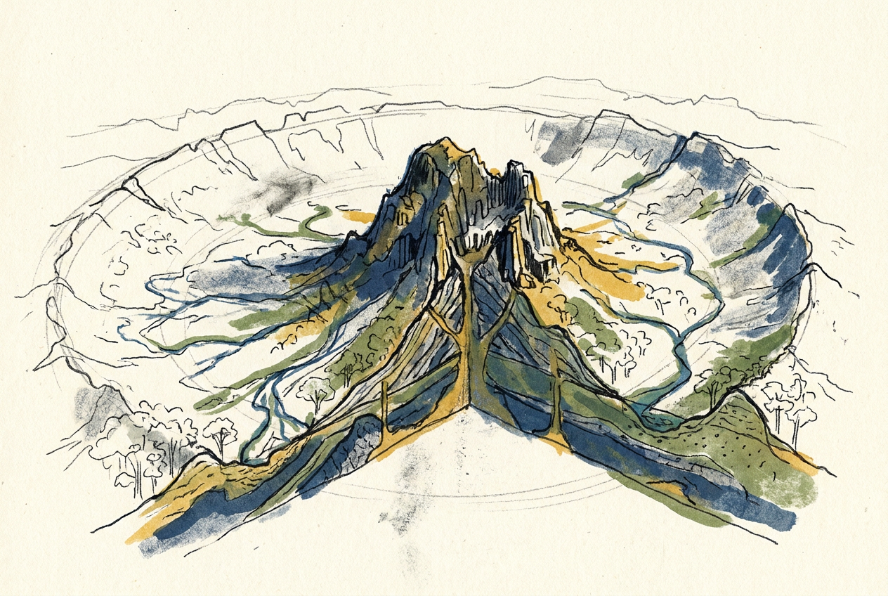
Mount Warning, the 23-million-year-old remnant of a shield volcano, reveals how erosion stripped away 1,000 metres of rock to expose the Tweed Volcano's plumbing.
Mount Warning rises 1,156 metres above the New South Wales coast, but it was once buried. The peak visible today is not the summit of an ancient volcano. It is the volcano's throat—the hard plug of magma that fed the mountain, exposed after 23 million years of rain, wind, and chemical decay stripped away everything softer around it.
The Tweed Volcano, of which Mount Warning is the central remnant, was one of Australia's largest shield volcanoes. It erupted between 23 and 20 million years ago, when the Australian plate drifted northward over a stationary hot spot—the same hot spot that built the volcanoes of eastern Australia in a southward-younging chain. At its peak, the Tweed Volcano probably rose to about 2,000 metres above sea level and spanned more than 100 kilometres across. Today, only its roots remain.
The Hot Spot That Dragged South
The hot spot that fed the Tweed Volcano sits now beneath the Tasman Sea, east of Tasmania. But 23 million years ago, the plate's northward drift positioned the hot spot under what is now the border of New South Wales and Queensland. Magma rose through the crust, erupted as basalt flows, and built a broad, gently sloping shield volcano.
What makes the Tweed Volcano unusual is what happened after it stopped erupting. The volcano's own weight caused the crust beneath it to sag, creating a broad depression. Later, regional uplift tilted the entire landscape. Then erosion began its slow dissection.
Erosion does not simply wear mountains down. It reveals what was always there, hidden inside.
The Plug That Held
The central vent of the Tweed Volcano was filled with magma that cooled slowly into a tough rock called trachyte—harder and more resistant to weathering than the surrounding basalt flows. As the softer basalt eroded away over millions of years, the trachyte plug remained, standing as a steep-sided monolith.
Mount Warning is not the only remnant. The Tweed Volcano's erosion has produced a ring of distinctive landforms. The caldera rim, now worn down, forms the semicircular McPherson Range on the Queensland side and the Tweed Range on the New South Wales side. These ranges are the eroded remnants of the volcano's outer slopes. Between them lies a broad, fertile valley—the ancient caldera floor, now farmland.
The erosion removed roughly 1,000 metres of volcanic rock, exposing not only the central plug but also the volcano's internal plumbing: dykes, sills, and layered intrusions that once fed eruptions at the surface.
The Valley That Was a Caldera
The caldera of the Tweed Volcano, now drained of its volcanic contents, holds a different kind of richness. The fertile soils derived from weathered basalt support some of Australia's most productive agricultural land—banana plantations, macadamia orchards, dairy pastures—all growing in the collapsed bowl of an extinct volcano.
The caldera's rim, where the hardest rock survived, forms a near-continuous escarpment that captures rain. The Tweed Valley receives over 1,500 millimetres of rain annually, sustaining rainforest remnants that cling to the steep slopes. These patches of subtropical rainforest are among the southernmost in Australia, relics of a wetter climate that once stretched farther south.
The Peak That Demands Respect
Captain James Cook named Mount Warning in 1770, noting it as a landmark for navigators approaching the dangerous reefs of the northern New South Wales coast. He did not know he was naming the stump of a volcano. The Bundjalung people, who had lived in the mountain's shadow for thousands of years, called it Wollumbin—"the cloud catcher"—a name that describes the mist that often shrouds its summit.
Today, the peak is a national park, protected for its geological significance and its biodiversity. The climb to the summit is steep, gaining nearly 800 metres in elevation over four kilometres. From the top, on a clear day, you can see the outline of the eroded caldera, the patchwork farms on the ancient caldera floor, and the Pacific Ocean stretching eastward. What you cannot see is the 1,000 metres of rock that once covered the ground beneath your feet.
That rock is now sediment on the seafloor, or soil in the valley, or dust in the wind. The mountain that walks does so slowly, grain by grain.
More like this
- The 110-Million-Year-Old River That Runs Backwards UndergroundWestern Australia's 110-million-year-old dune system has been slowly dissolving into a labyrinth of caves where an ancient river still flows, carrying the taste of a Cretaceous desert.
- The 5,000-Year-Old Volcanoes That Still Smoke in the SouthIn Victoria's Newer Volcanics Province, 400 volcanic vents erupted as recently as 5,000 years ago—the youngest volcanic field in mainland Australia, where craters still hold blue lakes and scoria cone
- The 300-Million-Year-Old Forest That Died Standing UpIn New South Wales, a 300-million-year-old fossil forest preserves dozens of trees buried upright by a Permian volcanic eruption—an entire ecosystem frozen in ash.