13 May 2026 · 3 min read
The Eggshell Floor: Lake Eyre's Salt Crust
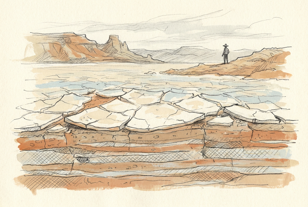
Lake Eyre's salt crust—up to 50 cm thick—records 30,000 years of alternating flood and drought across Australia's lowest point, 15 metres below sea level.
Fifteen metres below sea level, the floor of Lake Eyre is not water but salt—a crust up to half a metre thick that cracks underfoot like frozen porcelain. This is Australia's lowest natural point, a dry heart that has filled with water only three times in the past century.
The salt does not sit still. It grows, fractures, buckles, and heals.
The Basin That Refuses to Fill
Lake Eyre is the terminal sump of a drainage basin covering one-sixth of Australia—roughly 1.2 million square kilometres. Rivers from Queensland, the Northern Territory, and South Australia feed toward this single low point, but the journey is long and the evaporation fierce. Most years, the water never arrives.
When it does—after rare, sustained rainfall in the monsoon country far to the north—the lake transforms. Water spreads across the 9,500-square-kilometre salt pan, dissolving the upper crust. Algae bloom. Pelicans arrive by the thousands. For a few months, the dead heart looks alive.
Then the water evaporates, and the salt re-crystallises.
The Chemistry of a Crust
The salt is mostly halite—sodium chloride—but it carries a signature of the continent's deep past. Beneath the surface, groundwater rises through ancient sedimentary basins, leaching dissolved minerals from rocks deposited when this part of Australia lay under a Cretaceous sea. The salts are the ghost of that ocean.
Each drying cycle adds another layer. The crust grows in polygonal patterns, the familiar cracking of drying mud scaled to a continental basin. In some places, the salt forms tepee structures—ridges pushed upward by the pressure of crystallisation below. In others, it lies flat and glassy, reflecting the sky so perfectly that early surveyors mistook it for open water.
The lake fills on average once per decade, but a full basin—deep enough to sail across—has occurred only three times since European record-keeping began.
The Landscape Below the Salt
Beneath the crust lies what geologists call the Lake Eyre Basin—a sedimentary sequence that records 60 million years of Australia's northward drift. The basin began as a series of river valleys in the Palaeocene, when Australia was still attached to Antarctica. As the continent rifted north, the landscape slowly sagged, creating a depression that has been collecting sediment ever since.
Drill cores reveal the history in layers: river sands from wetter epochs, clay from floodplain lakes, gypsum from periods of intense aridity, and finally the thick halite of the present. The salt itself is young—the oldest layers date to about 30,000 years ago, when the last ice age lowered sea levels and dried the continent enough to concentrate the brines.
A Moving Crust
The salt is not a static cap. It moves with the water table, rising and falling as groundwater pressure shifts. In dry years, the crust hardens and cracks into plates that curl upward like shards of pottery. In wet years, the surface softens into a treacherous sludge that has swallowed vehicles and livestock.
Microbial mats grow between the salt crystals, staining the surface pink and orange with carotenoid pigments. These living films stabilise the sediment, trapping windblown dust and seeding the next generation of crystals. They are among the few organisms that can tolerate the brine—a salinity ten times that of the ocean.
When the lake floods fully, the salt dissolves entirely, and the landscape resets. The next drought will produce a new crust, different in pattern and thickness from the one before. Lake Eyre is never the same place twice.
More like this
- The 110-Million-Year-Old River That Runs Backwards UndergroundWestern Australia's 110-million-year-old dune system has been slowly dissolving into a labyrinth of caves where an ancient river still flows, carrying the taste of a Cretaceous desert.
- The 5,000-Year-Old Volcanoes That Still Smoke in the SouthIn Victoria's Newer Volcanics Province, 400 volcanic vents erupted as recently as 5,000 years ago—the youngest volcanic field in mainland Australia, where craters still hold blue lakes and scoria cone
- The 560-Million-Year-Old Garden That Never Saw a PredatorIn South Australia's Flinders Ranges, 560-million-year-old Ediacara surfaces preserve entire seafloor communities of fronds, discs, and quilts — a garden of soft-bodied life that flourished before pre