14 July 2026 · 3 min read
The 650-Million-Year-Old Glaciers That Scratched a Continent
In the Flinders Ranges, 650-million-year-old glacial deposits record the Sturtian Snowball Earth, with striated pavements and dropstones that prove Australia once lay under kilometres of ice near the
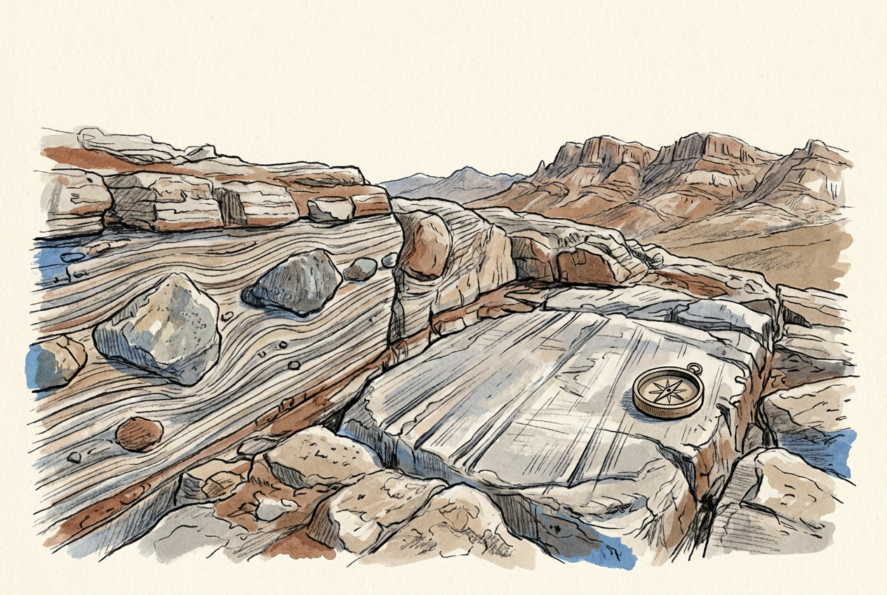
In the Flinders Ranges of South Australia, a 650-million-year-old rock surface carries scratches that could only have been made by ice. The grooves run northeast to southwest, parallel and precise, etched into the underlying pavement by stones frozen into the base of a moving glacier. There is no other force on Earth that leaves this signature.
These are striated pavements, and they belong to the Sturtian Glaciation — the first and most severe of the Snowball Earth episodes, when the entire planet may have frozen solid.
The Evidence of Deep Freeze
The glacial deposits of the Flinders Ranges are called the Sturt Tillite, named for the explorer Charles Sturt who first noted the strange boulders embedded in fine-grained sediment. The rock is a diamictite — a chaotic mix of pebbles, cobbles, and house-sized boulders suspended in a mudstone matrix. These are not river deposits. Rivers sort their sediment by size. Glaciers dump everything.
Some of the boulders are faceted and striated, ground flat on one side as they scraped against bedrock. Others are dropstones — rocks that fell from the base of melting icebergs into quiet seafloor mud, puncturing the soft sediment layers like a stone dropped into wet cement. The contrast between the angular, exotic boulders and the fine laminated siltstone beneath them is so sharp that a geologist can read it from across a gully.
The Sturt Tillite is not a single formation but a series of glacial advances and retreats recorded across 200 metres of rock, spanning perhaps 10 million years of freeze-thaw cycles.
A Continent at the Equator
The most unsettling fact about these glacial deposits is where they formed. Palaeomagnetic measurements of the Sturt Tillite show that the Flinders Ranges lay within 10 degrees of the equator when the ice advanced. The same data holds for glacial deposits of the same age in Canada, Africa, and Brazil. The entire planet, from pole to pole, was a snowball.
The mechanism remains debated. The leading hypothesis involves a runaway ice-albedo feedback: once ice sheets spread beyond about 30 degrees latitude, they reflected so much sunlight that the planet could not warm itself. The oceans froze to depths of a kilometre or more. Only volcanic outgassing, building carbon dioxide in the atmosphere over millions of years, eventually broke the freeze.
What the Pavements Tell Us
The striated surfaces in the Flinders Ranges are not merely historical curiosities. They record the direction of ice flow, which tells geologists where the continental centres of ice accumulation sat. In the Sturtian, the ice flowed from a highland to the northeast — possibly the Gawler Craton, which may have been a plateau comparable to the East Antarctic Ice Sheet today.
The striations also reveal that the ice was wet-based, meaning the glacier was warm enough at its base to slide. This is important. A cold-based glacier, frozen to its bed, does not scratch the rock. A wet-based glacier moves, erodes, and deposits. The Sturtian ice was alive and moving, even as the planet sat in deep freeze.
The Legacy in the Landscape
The Sturt Tillite caps many of the flat-topped mesas that characterise the central Flinders Ranges. The glacial rock is more resistant to erosion than the softer sediments beneath it, so it forms a protective armour — a duricrust of ancient ice debris that preserves the underlying topography. Walk to the edge of a mesa in the Bunyeroo Gorge area, and you stand on a 650-million-year-old glacial moraine.
Below the tillite lies the Burra Group, a sequence of sedimentary rocks deposited in the rift basins that preceded the glaciation. Above it, the interglacial sediments of the Umberatana Group record the return of open water, then the second Snowball pulse of the Marinoan Glaciation about 635 million years ago. The entire Cryogenian Period, from 720 to 635 million years ago, is preserved in this single mountain range.
The scratches on the pavement near Copley are not deep. A few millimetres at most. But they record a time when the Earth was a white ball in space, when all life clung to hydrothermal vents and thin equatorial seas, and when the rocks of what would become South Australia lay buried under ice kilometres thick — grinding, slowly, toward the equator. The scratches are still there, still readable, still pointing in the same direction they did when the last glacier melted away.
More like this
- The 500-Million-Year-Old Sponge That Grew a Glass SkeletonIn South Australia's Flinders Ranges, 500-million-year-old hexactinellid sponges built skeletons of silica glass, recording the moment when life learned to mine the sea for minerals.
- The 500-Million-Year-Old Mud That Turned to GlassIn the Flinders Ranges, 500-million-year-old Cambrian mudstone preserves the earliest known trilobite eyes—compound lenses made of calcite that still function as optics half a billion years later.
- The 1.1-Billion-Year-Old Meteorite That Left No CraterIn the Amadeus Basin, 1.1-billion-year-old impact melt rock preserves the oldest known meteorite impact in central Australia—a collision that left no crater, only a scattered field of shocked sandston