14 July 2026 · 3 min read
The 500-Million-Year-Old Sand That Travelled 3,000 Kilometres to Become a Mountain
Frenchmans Cap in Tasmania preserves 500-million-year-old sediment that travelled thousands of kilometres across an ancient ocean floor before being folded into a mountain.
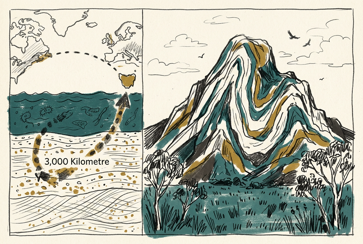
In Tasmania's remote southwest, a 400-metre-high quartzite peak called Frenchmans Cap sits atop a layer of rock that was once the seafloor of an ancient ocean. The mountain is made of sediment that travelled thousands of kilometres across an ocean floor, then was crushed and folded into the crust of a continent that did not yet exist. The story of that journey is written in the rock itself.
The Ocean That Vanished
During the Cambrian Period, around 500 million years ago, a deep ocean basin lay between what would become Tasmania and the rest of Australia. This was the Kanmantoo Trough, a submarine trench that accumulated sediment eroded from the adjacent Gondwanan landmass. Layer upon layer of sand and mud settled onto the seafloor, compacting into sandstone and shale.
Then the ocean closed. The tectonic forces that assembled Gondwana pushed the two sides of the basin together, squeezing the sediment like a concertina. The rocks that had been deposited horizontally were tilted, folded, and thrust upward. What had been a flat seabed became a mountain range.
The Fold That Exposed the Past
Frenchmans Cap is a syncline—a downward fold in the rock layers that was later inverted by uplift and erosion. The younger quartzite that once sat at the bottom of the trough now caps the peak, while older rocks are exposed in the valleys below. This geological inversion means that walking from the summit to the valley floor is a journey backward in time.
The quartzite itself is remarkable. Originally a sandstone composed of quartz grains eroded from older granite, it was buried deep enough to recrystallise into a dense, hard rock. The metamorphism erased many original sedimentary structures, but the bedding planes remain visible as faint stripes across the mountain's face.
The mountain is an upside-down archive: the youngest rocks sit at the top, the oldest lie in the valleys.
A Journey of Thousands of Kilometres
Geochemical analysis of zircon grains in the Frenchmans Cap quartzite reveals something unexpected. The zircons are not local. Their ages match rocks in Antarctica and South Africa, not in Tasmania. The sediment that built the mountain was carried by rivers and ocean currents across the Kanmantoo Trough, travelling perhaps 3,000 kilometres before settling on the seafloor.
This means Frenchmans Cap preserves a record of erosion and transport that spanned an entire continent. The sand grains that now form the summit were once part of mountains in what is now East Antarctica, ground down by weathering and carried northward by ancient river systems. The mountain is a monument to the slow recycling of the Earth's surface.
The Glacial Polish
During the Pleistocene, ice caps covered Tasmania's highlands. Glaciers flowed down the flanks of Frenchmans Cap, scraping and polishing the quartzite. The glacial striations—parallel scratches gouged into the rock by debris embedded in the ice—are still visible on the summit plateau. They record the direction of ice flow and the power of the glaciers that once shrouded the peak.
The combination of tectonic folding, metamorphism, and glacial erosion has produced a landscape of extraordinary clarity. The white quartzite gleams in the sunlight, visible from kilometres away. It is one of the few places on Earth where the deep structure of a mountain range is laid bare for anyone who cares to read it.
More like this
- The 1.7-Billion-Year-Old Bacteria That Built a MountainIn Western Australia's Hamersley Range, 1.7-billion-year-old stromatolites from the Duck Creek Formation record the oldest known freshwater reef—built by cyanobacteria, not corals.
- The 550-Million-Year-Old Quilt That Learned to MoveIn South Australia's Flinders Ranges, 550-million-year-old Dickinsonia fossils preserve the oldest known mobile animals—soft-bodied creatures that fed by absorbing nutrients through their quilted surf
- The 2.7-Billion-Year-Old Lava Tubes That Still Run Along a ScarpThe Darling Scarp in Western Australia preserves a 2.7-billion-year-old chain of Archaean lava tubes, the oldest known volcanic plumbing system on Earth.