13 July 2026 · 4 min read
The 270-Million-Year-Old Earthquakes Frozen in Sandstone
Along the New South Wales coast, 270-million-year-old sandstones preserve the record of ancient earthquakes that turned the seafloor to liquid.
On the floor of a shallow Permian sea, 270 million years ago, a single tremor turned thousands of tonnes of sand and silt into jelly. That quake—and dozens more like it—left a record written not in stone, but in stone that was never meant to hold its shape: a landscape of frozen waves, shattered beds, and sand that still flows like treacle beneath the baked surface of the Sydney Basin.
The Day the Seafloor Turned to Liquid
A shallow sea covered much of eastern Australia during the Permian, roughly 270 million years ago. Along its margin, rivers fed thick sequences of sand, mud, and peat into a subsiding basin. The sediment piled up in layers, waterlogged and unstable. Then a seismic shock—from a fault, perhaps, or the distant rumble of a rising volcanic arc—passed through the saturated sand.
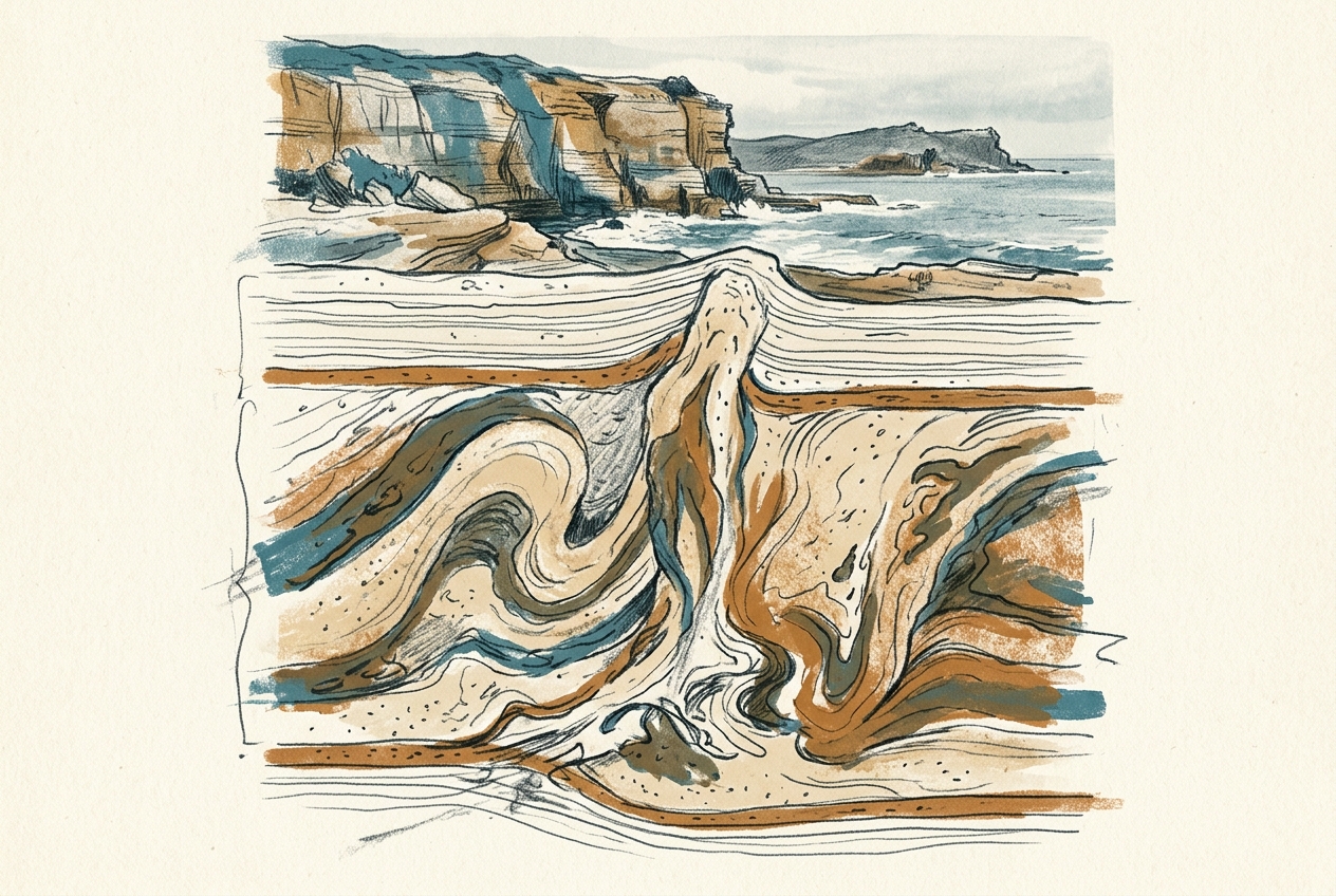
When the ground shakes in waterlogged sediment, the grains lose contact with one another. The pressure of the water between them spikes, and the entire bed behaves like a liquid. Sand volcanoes erupt from the surface. Layers slump and fold. Beds of sandstone fracture and fill with injected sand that now stands as vertical dykes of stone.
The entire sequence became a record of each earthquake, frozen in cross-section.
A Wave That Stopped Mid-Crash
One of the most striking features of the Shoalhaven Group, which crops out along the coast south of Sydney, is the presence of soft-sediment deformation structures within the Snapper Point Formation and the Wandrawandian Siltstone. These formations are exposed on the shore platforms between Ulladulla and Batemans Bay, where the sea has planed them flat and the tide washes over the evidence.
You can stand on a slab of siltstone and see a single bed that buckled into a recumbent fold—a wave of sand that slumped sideways and never broke. Adjacent beds show load casts: bulbous lobes of sand that sank into underlying mud like stiff dough dropped into batter. Pipe-like structures called clastic dykes cut vertically through the sequence, filled with sand that once erupted onto the seafloor.
The ground remembers every tremor, if you know how to read the sand.
These are not tectonic folds, squeezed by mountain-building over millions of years. They formed in minutes. Each one records a discrete seismic event that struck while the sediment was still wet.
A 10-Million-Year Archive of Ancient Tremors
The Shoalhaven Group spans roughly 10 million years, from the Early to Middle Permian. Within that interval, the deformation structures appear in discrete horizons, separated by undisturbed strata. Each horizon likely corresponds to a major earthquake—possibly magnitudes 6 or 7—that rattled the basin floor.
The tectonic driver was the New England Orogen, a convergent plate boundary to the east. As a volcanic arc collided with the continental margin, the foreland basin flexed and shuddered. The earthquakes were not random; they followed the slow collision of Gondwanan fragments that would eventually assemble the eastern edge of Australia.
These Permian seismic horizons are among the oldest earthquake records in the world that preserve not just a single event but a repeated cycle of shaking, liquefaction, and quiescence.
Why the Sand Held Its Shape
Normal sandstone, once lithified, is rigid. But the sand in the Shoalhaven Group was never fully cemented when the earthquakes hit. It remained porous and water-filled, primed to fail. The mud layers above and below acted as seals, trapping the water pressure. When the seismic wave arrived, the sand flowed—and the mud above it recorded the flow in exquisite detail.
The same process happens in modern earthquakes. In Christchurch in 2011, liquefaction turned suburbs into slurry. Along the shores of New South Wales, the same phenomenon has been frozen in stone for a quarter of a billion years.
Scientists have mapped these structures along hundreds of kilometres of coastline. The consistency of the deformation across such a wide area suggests that the earthquakes were not local—they were rooted in the same deep crustal processes that would eventually lift the Great Dividing Range.
The Quietest Earthquake Museum on Earth
Most of Australia's seismic record is lost—erased by erosion, metamorphism, or the slow creep of the continent across latitudes. But the Sydney Basin, still largely undeformed, offers a rare archive. The best exposures lie on the wave-cut platforms at Bendalong, Durras North, and Ulladulla, where the Southern Ocean has washed the rock clean.
You can walk these platforms at low tide and trace a single bed for tens of metres. The folds tighten and loosen along the outcrop. The clastic dykes widen and narrow. The whole sequence reads like a seismogram written in sand.
There is no visitor centre. No plaque explains the ripple of a 270-million-year-old tremor. But the evidence is there, exposed twice a day by the same tide that once shook the seafloor into a liquid state.
More like this
- The 585-Million-Year-Old Embryos That Refuse to DecayIn the Ediacaran hills of South Australia, 585-million-year-old fossils preserve the earliest known animal embryos, their cells still visible in phosphate.
- The 340-Million-Year-Old Reef That Slid Off a CliffIn the Kimberley, a 340-million-year-old reef slid intact off a cliff, preserving an entire Carboniferous coral ecosystem as a single rotated slab.
- The 124,000-Year-Old Forest That Now Grows Under the Sea124,000-year-old trees still standing upright on the seafloor of Spencer Gulf record a warmer world and the pace of ancient sea-level rise.